

What is GeoSAFE?
“GeoSAFE is a web platform that provides the ability to run InaSAFE analyses online”
InaSAFE is free software that produces realistic natural hazard impact scenarios for better planning, preparedness and response activities.
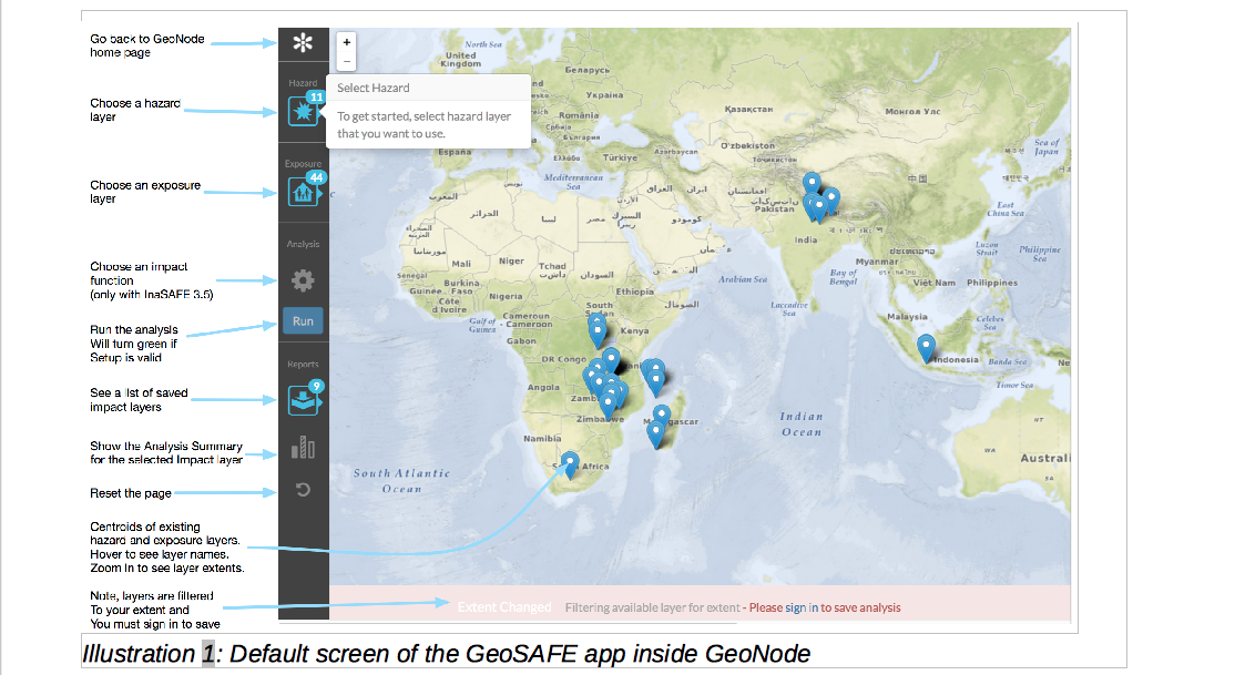
GeoSAFE is free software. It is a Django app that is integrated into GeoNode with the QGIS server back-end.
GeoSAFE lets you use existing hazard and exposure layers or upload your own and then run an InaSAFE impact function. The InaSAFE impact layer and analysis reports are saved for future reference or download.
You try:
Goal: Overview of GeoSAFE workflow
Prepare data in InaSAFE Desktop
- capture InaSAFE keywords for hazard and exposure layers
Upload hazard and exposure layers to GeoSAFE
- These are normal GeoNode layers with InaSAFE keywords in their metadata
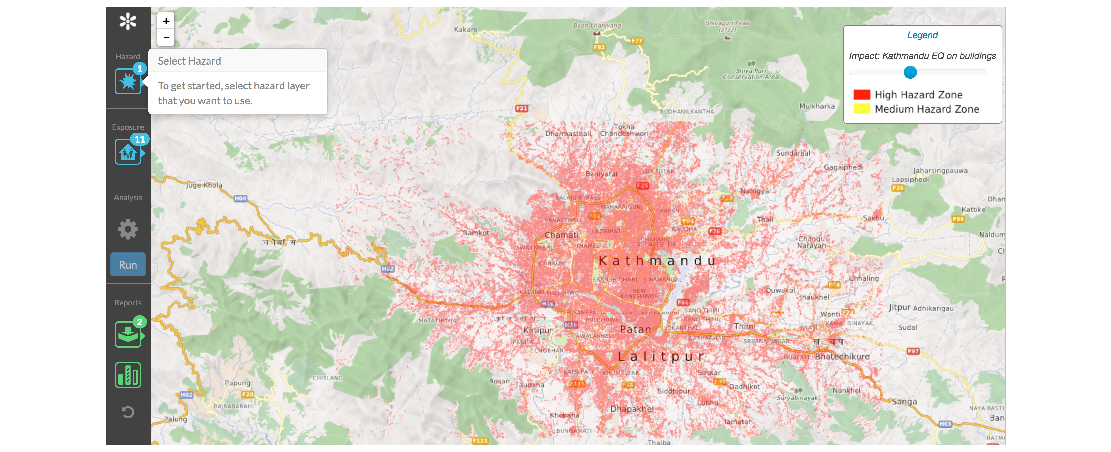
Set up and run an analysis
- Choose a hazard layer and a compatible exposure layer in the GeoSAFE app.
- Run the analysis and wait for it to complete
View or download the output layers and reports
- Impact and table report
- Impact layer
More about
- You don’t have to install any software to run GeoSAFE (unless you need to prepare your own data sets). It just runs in a browser.
- InaSAFE, because it runs in QGIS Desktop, has a full suite of GIS functionality available to the user. GeoSAFE is for running analyses and sharing results.
- InaSAFE desktop is for data preparation and analysis. GeoSAFE is for analysis.
- Minimum needs can easily be modified in InaSAFE. GeoSAFE uses minimum needs that the system administrators set up.

Further reading:
-
GeoSAFE demo http://geonode.kartoza.com
-
GeoSAFE user documentation https://drive.google.com/open?id=0B2pxNIZQUjL1Q1RkVHhVTXAzOWc