

Using GeoSAFE results in QGIS
“After running analysis in GeoSAFE users can download and review the analysis result dataset in QGIS”
In this module we explore visualising impact analysis output in desktop QGIS
You try:
Goal: To explore and understand the GeoSAFE results with relation to attributes and legends.
- Log into GeoSAFE
- Navigate to GeoSAFE menu and select analysis list from the drop down.
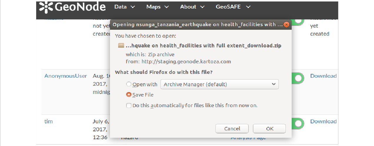
- Select the result from the list and choose download.
- Save the result file.
- Navigate to the download directory. The location depends on the browser you are using.
- Unzip the saved directory
- In QGIS use the add vector dialog and load the Layer from the folder generated after unzipping.
- Add a Background layer to give context for your results.
- Right click on the vector layer and open the attribute table. (Use the various QGIS tools to explore the data)
- Open the report table from the unzipped folder.
Check your results
In QGIS you should have a vector layer loaded which has symbology defined for the impact layer.
| Name | Expectation |
|---|---|
GeoSAFE |
http://geonode.kartoza.com/ |
Browser |
FireFox , Google Chrome, Internet Explorer |
Location |
Download path for the browser |
Layer |
Impact layer with .shp extension |
Background layer |
OSM , Google earth |
QGIS tools |
Identify, Expressions, Select |
More about
For each analysis that has been run GeoSAFE keeps the impact layer and reports in place and this offers the flexibility that analysis done on different days can be compared. Since GeoSAFE is built with QGIS components the resultant layer can be directly viewed in QGIS or other desktop GIS software.

Check your knowledge:
-
Which of the following statements is true:
- The colours generated for the result layer are fixed and cannot be changed.
- The reports generated after running an analysis can be edited and saved on the server.
- A user can assign another colour to the impact results provided he has generated the symbology in QGIS.
-
Why do the maps generated in GeoSAFE look identical to the result layer you loaded in QGIS:
- Its coincidental.
- The download from GeoSAFE also downloads the symbology for the layer.
-
Do different browsers (Firefox, Safari) influence the appearance of the results:
- Yes, Safari is superior and the results look better.
- No the results are the same irrespective of the browser used.
- I do not know

Further reading:
-
qgis-adding-vector-data http://www.northrivergeographic.com/qgis-adding-vector-data