

Using the multibuffer tool in InaSAFE
“The multi-buffer tool provides a quick way to generate a polygon hazard dataset from a point hazard layer. In this exercise we show you a use case for using this tool.”
We mentioned previously that InaSAFE does not work with point hazard data. However there is a tool provided with InaSAFE that will produce concentric zones around a point-based hazard and assign a category to each zone. You can then treat this as a hazard layer, defining keywords for it and running your InaSAFE analysis.
You try:
Goal: To generate a hazard layer from a point dataset and use it in an analysis.
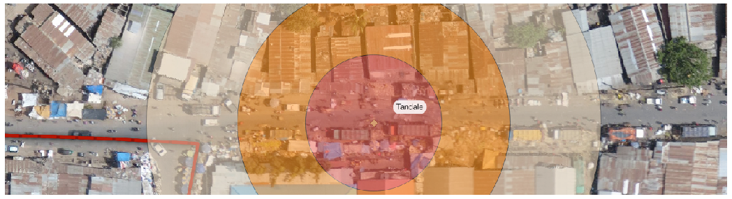
- Add the chemical-spill dataset to QGIS.
-
Use the multi-buffer tool (there is no toolbar icon for it so look in the Plugins -> InaSAFE submenu) to create a polygon dataset with three zones as indicated on the table, right.
-
Define keywords for the newly generated layer, taking care to set the hazard classifications as shown on the table below
-
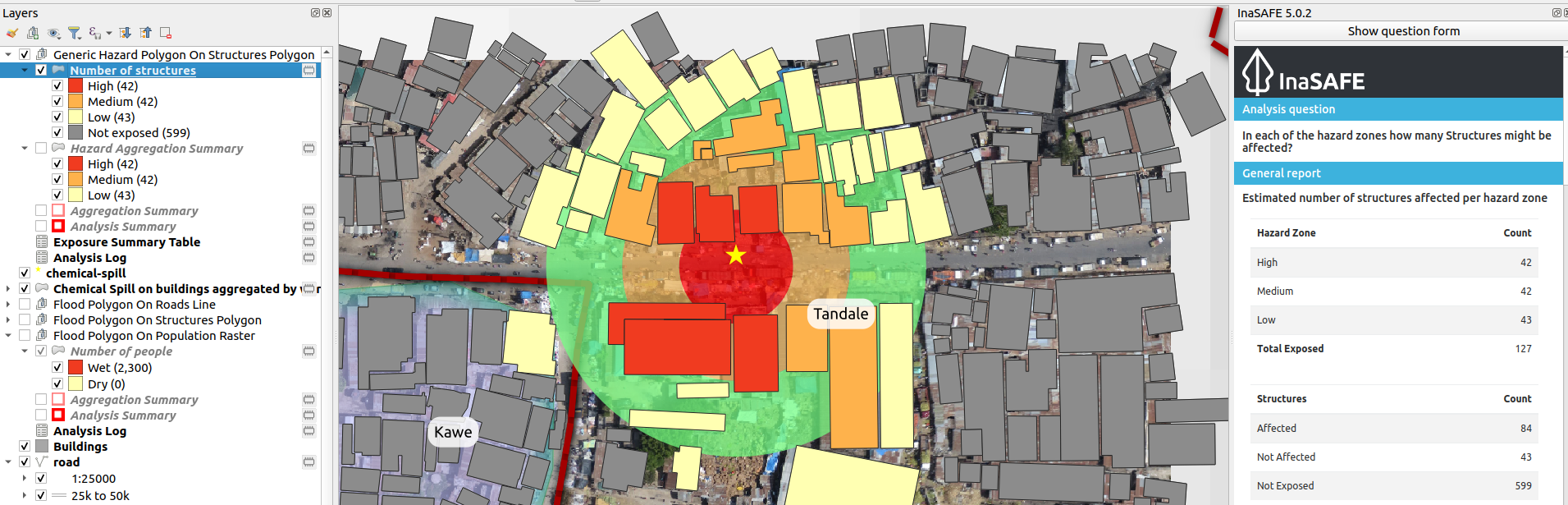
Now run the chemical spill on buildings InaSAFE analysis using the wards layer for aggregation.
Check your results:
How many buildings were affected in each hazard zone? Do your results match your neighbour’s?
| Name | Expectation |
|---|---|
Buffer Zone Severity: |
|
High |
15 |
Medium |
30 |
Low |
50 |
Keywords |
|
purpose |
Hazard |
Kind |
Generic |
Scenario |
Single event |
Classified field |
Hazard_class |
Hazard classifications: |
|
|
Generic classes |
|
Generic classes |
|
Generic classes |
|
Generic classes |
Hazard id |
id (or blank) |
Source, URL, Scale, Date, License |
Fill in as needed |
Title |
Chemical Spill on buildings aggregated by wards. |
Analysis |
Chemical spill on buildings aggregated by wards. |
More about
You can do the multibuffer process manually using standard tools in QGIS, but the InaSAFE Multibuffer tool makes the whole process very easy to buffer at multiple zones, add the needed keywords for InaSAFE and then use that layer as a hazard layer in InaSAFE.
Using buffer zones around a hazard should be based on a good scientific or knowledge based approach, otherwise the results produced may not be useful or may be misleading.

Check your knowledge:
-
InaSAFE does not support point using hazard data:
- True
- False
-
Mark all the correct statements:
- The multibuffer tool provides a way to run an analysis with hazard data derived from point data.
- The multibuffer tool works with polygon and line layers too.
- It is not possible to generate a multibuffer dataset without using the InaSAFE multibuffer tool.

Further reading:
-
See the multibuffer tool section in the InaSAFE user manual at: http://manual.inasafe.org/en/index.html#multi-buffer-tool
Download the sample data for the lesson.