Sources of Hazard data - Modelling
“Hazard data is more difficult to acquire than exposure data in many cases. In this module we look at modelling as an approach to the creation of hazard data.”
Modelling floods is an entire discipline in its own right. Flood modelling can be carried out by combining factors such as precipitation, geology and run off characteristics, terrain etc. to derive a model of impending or current flood. Modelling can use data interpolation techniques - e.g. by taking flood depth readings manually or using telemetry from various sites around the flood prone area, flood depths can be interpolated to estimate the depth at places that were not sampled.
Another modelling approach used by engineers is to install depth sensors upstream of the catchment and then try to model how much water is coming into the catchment area based on depth and flow rates. This has the potential advantage of giving early warning before floods enter the flood prone area, although it also has the disadvantage that localised rainfall may not be accurately considered in the model.
Using a digital elevation model (DEM) and a stream network, it is also possible to generate a simple model of which areas might be inundated by a water rise in the river network of a certain amount. DEM cells adjacent to the stream network which are below the flood-rise threshold will be considered flooded and then those cell neighbours can in turn be considered so as to ensure that only contiguous areas in the DEM are flagged as inundated. There are various other approaches that can be used to model flood potential that involve using a DEM.
One advantage of using a modelling approach is that it allows us to do forecasting for abnormal events. For example, there may not be localised knowledge about 50 or 100 year flood events and their impacts, but these can be estimated using modelling techniques.

You try:
Goal: To understand the role of modelled flood hazard data in InaSAFE
Form small groups and discuss the advantages and disadvantages of modelled hazard data (for hazards that are relevant to you) using the example on the requirements table below.
Consider:
- are there some hazards more suited to modelling than others?
- are there obvious advantages to using a model for hazard data?
- are there obvious disadvantages to using a model for hazard data?
Check your results:
Report your ideas back to the group. Were there any concerns or opportunities raised that your group did not think of?
| Name | Expectation |
|---|---|
Example: |
Accuracy may be very variable depending on the datasets used the algorithms employed. |
Advantages |
Does not require large amounts of human input, may provide insight into the impact of extraordinary events such as 100 year floods. |
Disadvantages |
A large number of techniques available make it difficult to choose an appropriate one. Algorithm parameters should be carefully tuned and high confidence in the input data used for modelling is needed |
Production speed |
Modelling events in realtime is possible but it may take some time to validate the model before it can be used in response activities. |

More about
The techniques that are available in GRASS for modelling floods are:
r.hazard.flood which is an extension in grass and the instructions on how to do that are accessed on the grass wiki.
r.lake and r.rake.series. r.lake is available in grass and can also be accessed via the processing interface in qgis and run for each simulation. r.lake.series is a grass extension only available in grass 7 which also supports simulation through the nviz module in grass.
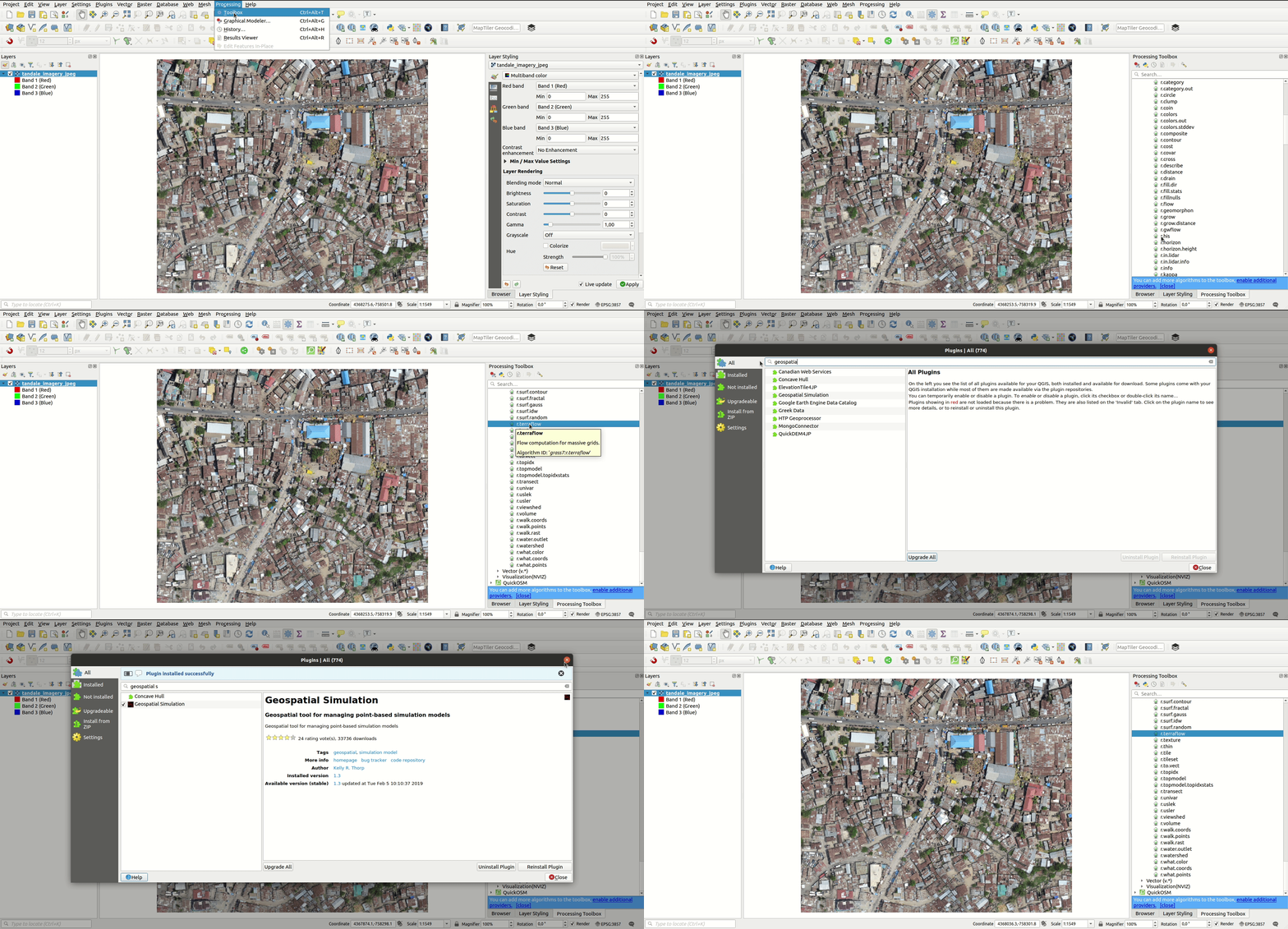
r.terraflow. Mainly used for flood modelling for rasters that are big. There are two variations of r.terraflow which stem from the type of data the DEM has. For cell type data there is r.terraflow.short which is used for this and is available in grass 6.
Techniques available in QGIS:
Using the processing module in QGIS one can access the modules in SAGA, OTB and GRASS. Installing a plugin named Geospatial Simulation also enables different flood modelling techniques to be visible in the processing toolbox.

Check your knowledge:
-
Indicate which of these hazards would be a good candidate for modelling when generating InaSAFE hazard datasets:
- flood
- earthquake
- chemical spills
-
True or false: Modelling a hazard is something that InaSAFE can do:
- true
- false

Further reading:
-
GRASS lake manual: http://grass.osgeo.org/grass64/manuals/r.lake.html
-
GRASS flood manual: http://grass.osgeo.org/grass72/manuals/addons/r.hazard.flood.html
-
GRASS terraflow: http://grass.osgeo.org/grass64/manuals/r.terraflow.html

