

Accessing Data using QuickOSM
“In this exercise, you will get data sets to use as exposure data in InaSAFE projects.”
We mentioned in the overview of exposure data that these data can be easily obtained from OpenStreetMap using the QuickOSM Plugin. Keywords will have to be assigned to the data generated by QuickOSM using the Keywords Creation Wizard.
You try:
Goal: To be able to add data from OSM and run an analysis with it in InaSAFE.
- Use the QGIS Browser panel to add the following datasets to your QGIS project: wards.shp, tandale_imagery.tif and tandale_floods.shp or equivalent wards, imagery and flood data from Bhutan exercise 2.2.
- If you do not have the Quick OSM plugin Install it as follows: Plugins menu> Manage and Install plugins> search QuickOSM> select QuickOSM> Click Install Plugin.
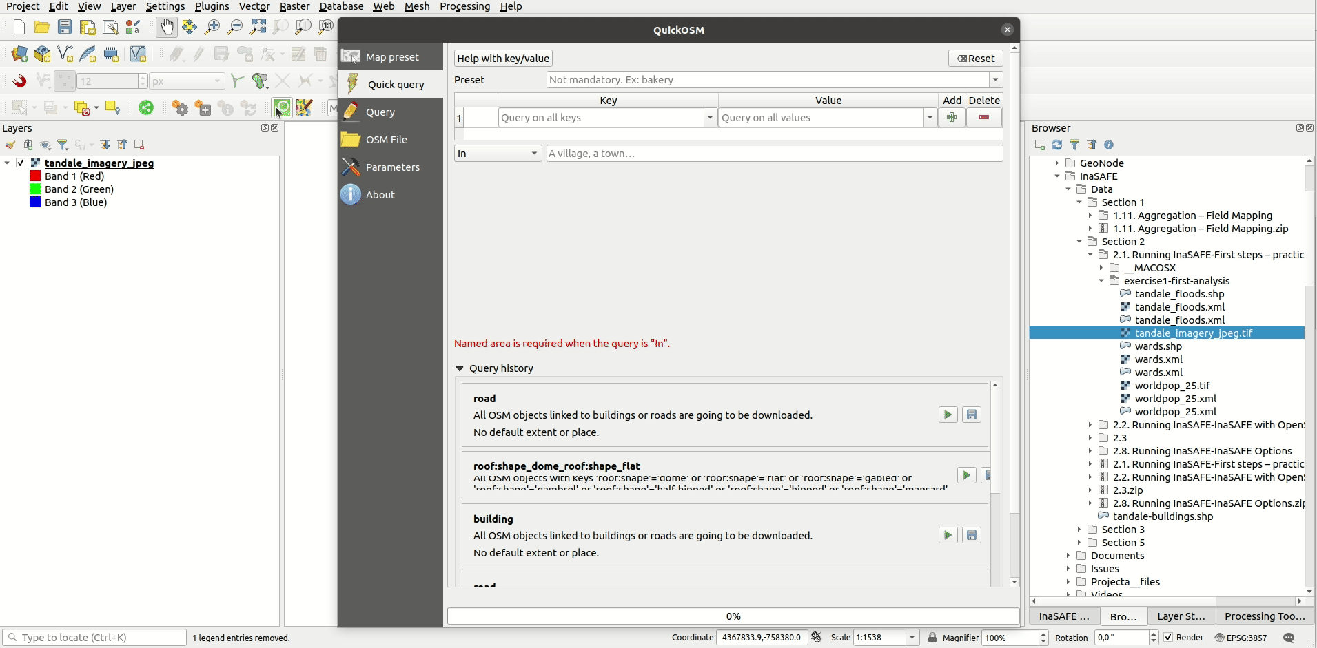
- Open the QuickOSP plugin by clicking on the green magnifying glass button.
- To quickly get all the buildings and roads for the canvas extent, click on the Map preset tab> select (highlight in blue) the default Urban preset> select the Canvas Extent from the In drop down>click Run.
- Layers for the buildings and roads in the area will be added to the project, make sure to save the temporary layers.
- Assign keywords to all of the layers using the Keywords Creation Wizard and following the step-by-step process for the hazard and exposure data.
- Run the InaSAFE Impact Function Centric Wizard for the flood hazard layer.
- Make sure to read the wizard instructions on each step carefully and make the most sensible choices (bearing in mind all the data are already loaded in QGIS).
Check your results:
How many buildings were affected by the flood? What length of roads were affected?
More about
Alternative data resources
- consider an alternative service for obtaining the data. Geofabrik for example Geofabrik is a nice service that provides support for this.
- for power users, there is docker-osm GitHub-docker-osm which provides a continuously synchronised mirror of the OSM database for a particular region.
Note:
If you use data from one of the other sources mentioned, you will need to create the styles and InaSAFE keywords for those layers yourself.
When using OpenStreetMap data, you should be careful to attribute it properly.

Check your knowledge:
-
True or false – OpenStreetMap data are free, there is no need to mention where it came from:
- true
- false

Further reading:
-
OSM Docker: https://github.com/kartoza/docker-osm
-
InaSAFE OSM downloader documentation: http://manual.inasafe.org/en/index.html#osm-downloader
-
OSM Reporter: http://osm.inasafe.org
-
Geo Fabrik: http://download.geofabrik.de
Download the sample data for the lesson.