

Bringing it all together in context
““The QGIS Map Composer is the layout or reporting component of QGIS. You might do your work on the canvas, but you show it off or publish it with the Composer.””
Maps are visual tools to communicate useful information to the user. The five basic elements of a map are map title, legend, map scale and projection, direction. Without any of these components of maps, the clarity of the map decreases and it makes it more difficult to comprehend and understand.
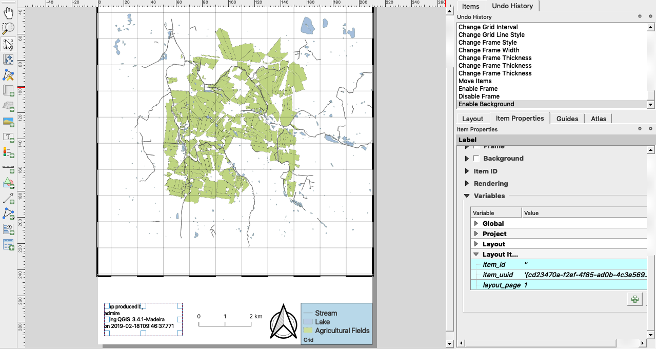
In this module, we combine the knowledge we acquired in the exercises Scale Bar, Legend and Map composer basics to make a map containing all the elements.
You try:
Goal: To create a map containing all the elements of a map.
- Load the exercise data.
- Set the map projection to EPSG:25832
- Add a new composer layout.
- Change the map page to Portrait. Right click on the empty map and change it there.
- Use the specification provided in the exercise Scale Bar to add a scale bar on the map.
- Use the specification provided in the exercise Legend to add a legend on the map.
- Use the specification for Grid 1 to add a map grid.
- Add a map title, give it a meaningful name.
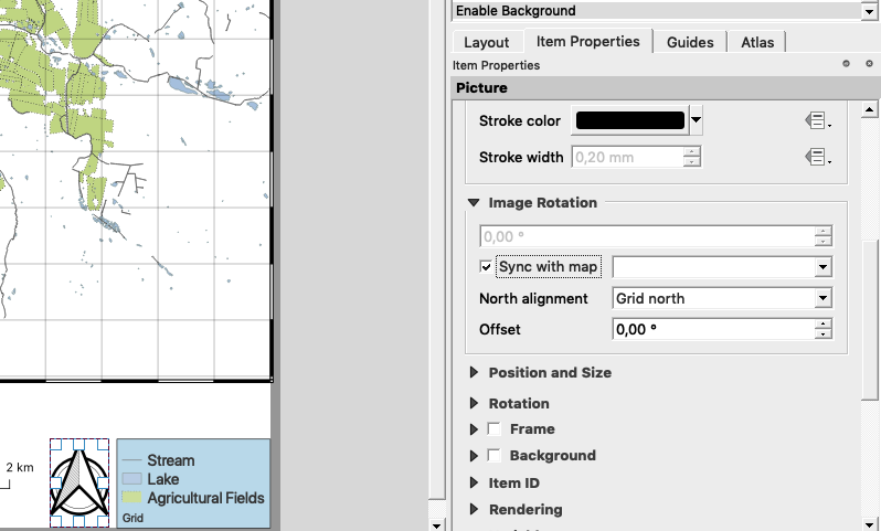
- Add a north arrow and in the item properties ensure the north arrow is in sync with the map.
- Add a map border.
- Use the specification for Credits to add a map credits.
| Name | Expectation |
|---|---|
Grid 1 |
CRS:25832, Interval And Y:1000, Grid line width:1mm,Frame:Zebra, Frame Size:1mm |
Map credits |
|
More about map composer
Besides adding the basic elements of maps users have a full set of tools that can be used to add other properties of maps so that they can portray useful information. In this module, we touched on the basic elements of maps but we could also add attribute tables to the maps, add overview maps, diagrams as well as map annotations. We also added in map credits and we saw how text items in maps can be combined with QGIS expressions to generate dynamic content. Whenever you see an expression like [% @qgis_version %] it represents an expression that is being evaluated on the fly. When adding a north arrow we added the option to make the north arrow sync with the map. This ensures that if the map is rotated the north arrow will also rotate so that the orientation of the north arrow is always north facing.

Check your knowledge:
-
When creating a map why is it not encouraged to use a CRS that is not projected:
- Because the distance on the map is relative to the distance on the ground
- As long as the legend is correct the CRS does not matter
- It does not matter what CRS you use on a map
-
Why is it important to ensure that when a map is rotated the north arrow also gets rotated:
- It is generally for aesthetic reasons. It should look pretty
- Because the north arrow should always be north facing to get the correct direction
- It does not matter because a user can always rotate the map himself
-
Can you combine expression with static text in map composer:
- No
- Yes

Further reading:
Download the sample data for the lesson.