

Digitising in Context
“Digitising in a GIS context is the process of converting analogue or hard copy information to digital geometries, usually by visual interpretation and manual tracing of the geographic features.”
In this module, we will learn how to create new records and how to populate the geometry and other attribute fields. We will also explore topology (the spatial relationship among features) and how snapping and CRS settings affect these.
You try:
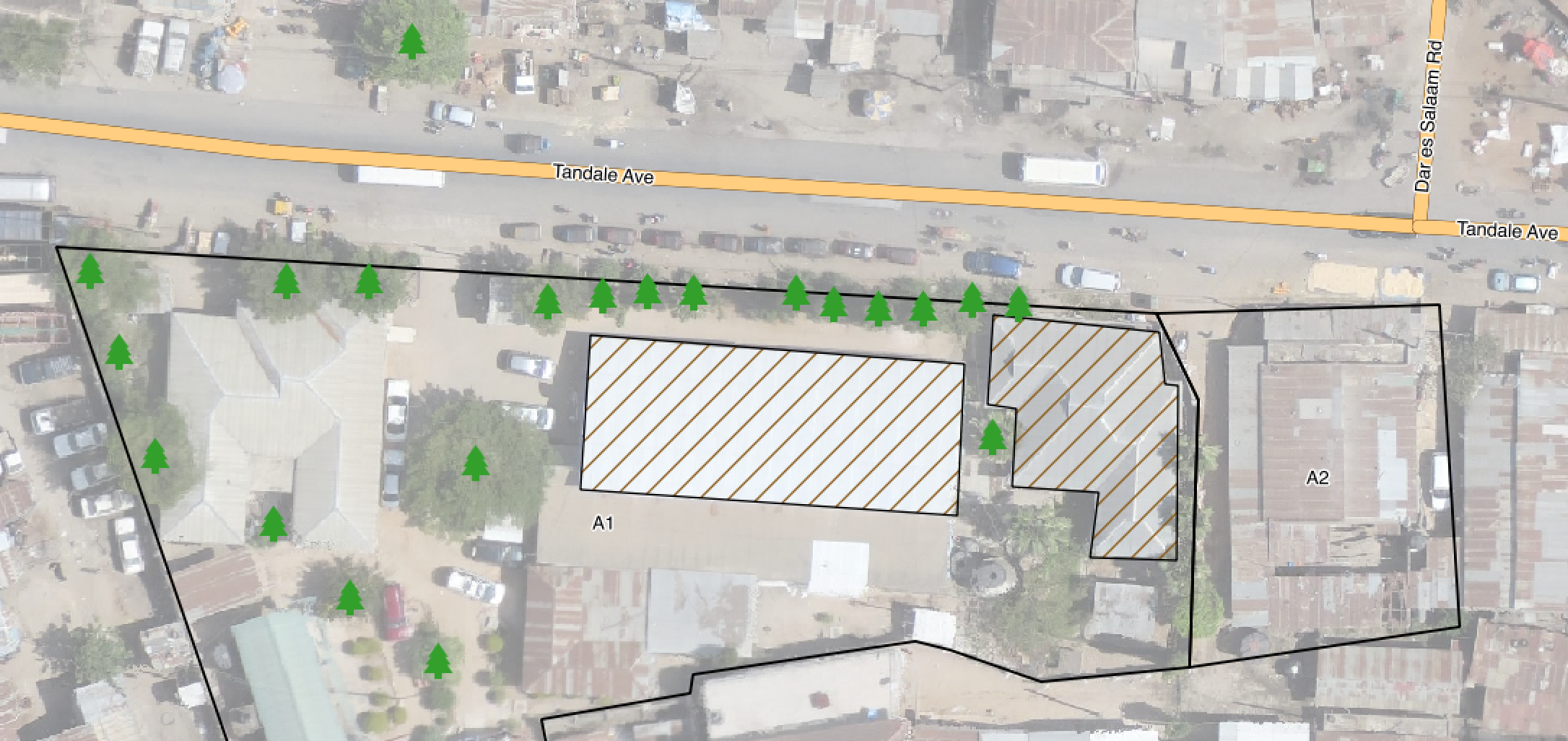
Goal: Capture Trees, Buildings, Parcels and Roads in Tandale, Dar es Salaam
- Load tandale_imagery.tif from exercise data (or other imagery with buildings and roads)
- Create a new vector layer for each of the four feature types
- Digitise two or more roads including an intersection
- Digitise one or more building outlines
- Digitise two or more adjacent land parcels
- Digitise some trees
- Label the parcels and roads
- Style each layer
Check your results
Does each road segment meeting at an intersection stop or start at the intersection?
What does it imply about the roads if their lines cross at the intersection instead
Do the nodes at the ends of the road segments coincide perfectly at the intersection?
What are the implications if the nodes do not coincide perfectly?
Are your geometries valid? Were there any little green crosses when the layer was in edit mode?
Do your adjacent land parcels overlap or are there gaps between them?
Describe two topological rules about land parcels.
| Name | Expectation |
|---|---|
Layer creation |
|
Create vector layer |
Shapefile, spatialite or scratch layer |
Vector Layer geometry type |
Multiline, Multipolygon, Multipoint |
Project setup |
|
Snapping Options |
Roads: vertex only Parcels: vertex and segment |
CRS |
EPSG:32737 (UTM37S) so that snapping uses metres |
Digitising (use the digitising toolbar) |
|
Vertex |
left-click |
Finish |
right-click |
Delete |
backspace |
More about
Digitising a point feature means creating a point representing an x, y coordinate. Digitising a line means creating a line feature that consists of a series of vertices connected by straight edges. The vertices at the ends of the line are often called start and end nodes. The order in which the vertices were digitised is often used to indicated flow of traffic or water so it can be important. Straight features require fewer vertices, curved/complex features require more vertices. Digitising a polygon means creating a line with three or more line segments that ends at its starting point. When digitising a layer, snapping should be configured so that the new features created adhere to that layer's topology rules.

Check your knowledge:
-
What is the main use of snapping when digitising:
- To make the layer look nice
- To ensure spatial relationships between features and layers are maintained properly
- It is not necessary
-
What could it mean if a building polygon intersects a parcel boundary:
- Poor digitising
- Land survey errors
- Illegal buildings
- All of the above
-
Which of these improves the accuracy of digitising:
- Increasing the scale (zooming in)
- Decreasing the scale (zooming out)
- Working in a projected CRS
- Working in a geographic CRS (unprojected or long/lat)
- All of the above
