

Ordering symbol in Context
“Symbol levels allow you to fine tune the rendering order of symbols. This is usually applied on layer having many symbol layers in one symbol.”
Symbol levels allow us to specify the rendering order of each symbol and its position relative to other symbols which define the symbol.
In this module, we will look at how symbol levels can be used to control the rendering order of symbol layers in a symbol.
You try:
Goal: To explore how symbol levels influence the rendering of symbols and the effect it generates on the style for each layer.
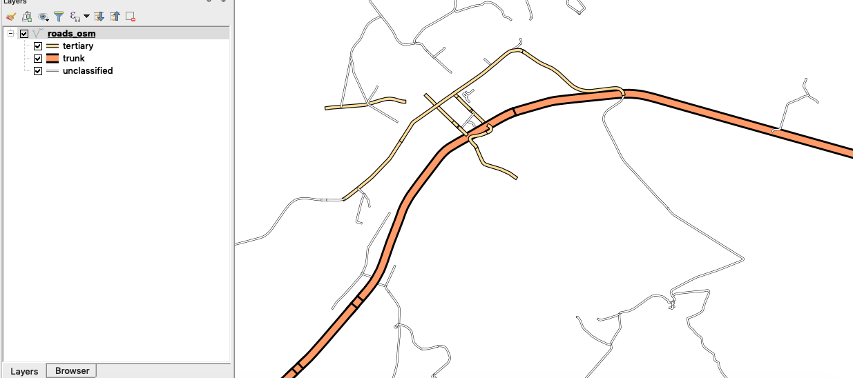
- Add the osm roads from the exercise data folder.
- Look at the symbology of the layer. This layer consist of two symbol layers. How can you ensure that the bottom symbol dashed white line is rendered on top of the back line?
- Load the style roads_osm_symbols.qml provided with the sample dataset. What can you infer about the symbology of the layer?
- Navigate to the properties of the layer and select symbology. Select the Advanced option and choose symbol levels.
- Enable symbol levels.
- Change the symbol levels so that your layer looks nice and obeys cartography rules.
NB: The symbol you need to be rendered first should have a value lower eg (0) that the one to be rendered on top (eg 1).
Check your results:
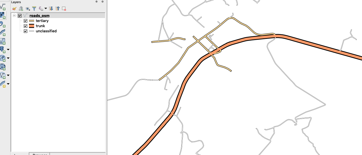
When you are done roads should flow into each other.
| Name | Expectation |
|---|---|
STYLE |
roads_osm_symbols.qml |
More about ordering symbols using symbol levels
Styles are all about communication. Very often that communication is scientific or statistical and therefore must represent the facts in an unbiased way. Or it could be topographical or navigational in which it should be clear and easy to understand. Or perhaps it purely artistic and just needs to look beautiful. The best maps combine all of these: accuracy, clarity and aesthetics. Effective styling applies the elements of good design.
Static maps are styled to look good at a specific scale. This can take a lot of work to achieve. Dynamic maps, such as interactive online maps (like OSM or Google), are styled to work at any scale. This is even harder to achieve since you need to style for multiple scales and also alter the data available for styling at each scale by filtering or generalising.
When choosing to symbolise a vector layer you have to decide whether a single symbol will adequately represent the feature properly or more symbols can be used. In cases when you have used more symbol you then need to specify the hierarchy or rendering order of each symbol so that you have symbology that looks nice and blends with the rest of your map layers. Examples of features that can have multiple symbols are railways and roads.
When symbol levels are properly applied you should achieve the effect depicted below in the image.

Check your knowledge:
-
Symbol levels depict:
- Two or more symbols that are used to represent a class or group of features in a vector layer.
- A type of vector layer that can be used in a GIS
- A type of vector analysis technique
-
Which of these statement is True:
- Symbol levels can only be used when the render type used to classify the roads is Categorized
- Symbol levels can be applied against any render type ie Categorised or Rule Based classification
- symbol levels were only designed for road layers
-
Symbol levels can be applied to raster layers:
- True
- False

Further reading:
Download the sample data for the lesson.