

Geoprocessing operations basics in Context
“Geoprocessing are a group of tools that are geared up for doing analysis. When dealing with vector data the tools include buffer, clip and dissolve.”
This module is very broad and we will look at some of the more common operations that are done using these tools.
You try:
Goal: To learn how to use geoprocessing functions
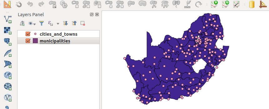
- Open the project geoprocessing from appendix4-geoprocessing.
- Create a filter on the Municipalities layer.
- Do a spatial selection using the tools available in QGIS to select cities within the filtered municipality.
- NB: Use the spatial predicates mentioned.
- Create a new column called province in the cities layer.
- Use field calculator to update the selected records to match the province name in the municipalities layer.
- Update the cities and towns to show a province name in which they are located.
Hint: Repeat the procedure above with a different filter each time.
Is there a better way to update the points so that they acquire the name of the province they exist in? - Using the filter_example dissolve all the municipalities to create a province layer and merge all the provinces layers created to form a country provincial layer.
- Explore how you can achieve the above task in an efficient way.
More about
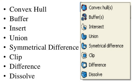
Geoprocessing algorithms are the building blocks for most vector analysis. When doing spatial selection there is greater need to understand and differentiate concepts like within, intersect, disjoins etc. The most common geoprocessing algorithms available in QGIS are:

Check your knowledge:
-
What is geoprocessing:
- It is a tool that is used to manipulate data.
- A collection of algorithm that do vector manipulation to produce new output.
- A type of GIS dataset that is available in QGIS.
-
Which of the following statements is true:
- A filter is applied in situations when you want to view a subset of the records.
- Filtering is a non GIS concept.
- A filter applies when dealing with only a polygon layer
-
Is select by location an example of a spatial operation:
- True
- False

Further reading:
-
Geoprocessing-in-qgis: https://www.slideshare.net/swethaashok28/geoprocessing-in-qgis
-
Geoprocessing-tools: http://gisgeography.com/geoprocessing-tools/
Download the sample data for the lesson.