
Project: InaSAFE
Changelog for version: 3.3.0
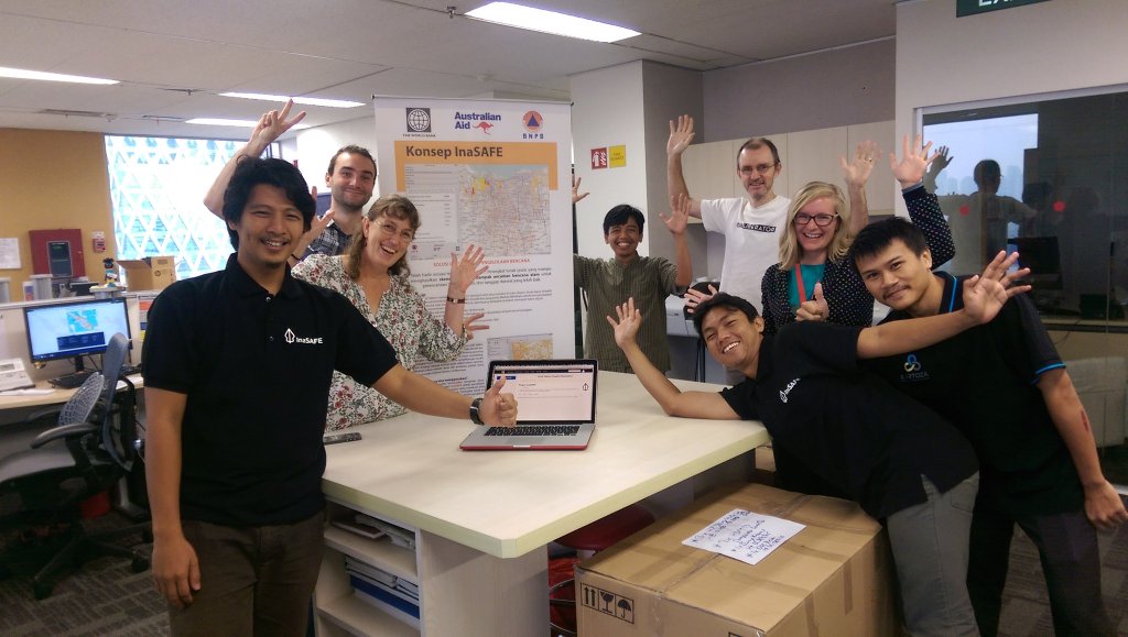
This is a feature release which focusses on improving the metadata implementation within InaSAFE and small improvements to the auxilliary tools provided with InaSAFE. Over 725 'commits' have been made to the code base since our 3.2.6 release. You can install this release using the plugin manager in QGIS (please restart QGIS after installing), or if you are a windows user, by using the standalone installation wizard.
Tools
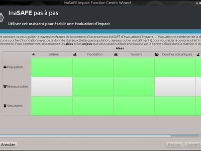
InaSAFE has been fully translated into French.
This feature was funded by WorldBank/GFDRR
This feature was developed by Kartoza
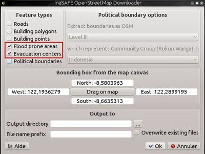
The OSM Downloader tool provides a convenient way to obtain exposure data and context data for the analysis area. In this release we have added support for downloading the following additional feature types:
- Evacuation centers
- Flood prone
This feature was funded by DFAT/DMInnovation
This feature was developed by Kartoza
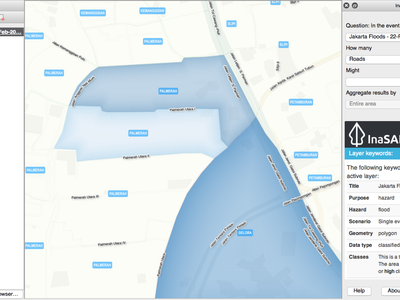
This tool will allow you to fetch a live snapshot of the PetaJakarta.org flood status and save it as a shapefile (complete with keywords ready for use in InaSAFE). The downloaded layer can automatically be named to include the date and time of the download - useful for comparing flood affected areas over time. PetaJakarta provides a number of different downloadable products. For this tool we use the areas [officially considered flooded[(https://petajakarta.org/banjir/en/data/v2/#flooded), where each polygon is rated according to this table:
State | Description -------|--------------------------------- 0 | Not flooded 1 | Use caution 2 | Water depth from 0-70cm 3 | Water depth from 71-140cm 4 | Water depth > 140cm
InaSAFE can use flooded areas either as 'wet/dry' areas or as 'high/medium/low' hazard areas. We have opted to provide metadata using the second scheme with the following mappings:
State | Hazard level -------|------------- 0 | Low 1 | Low 2 | Low 3 | Medium 4 | High
You can adjust these classifications as needed by using the InaSAFE keywords wizard. Lastly note that the PetaJakarta tool is specific to Jakarta. It can be found in ``plugins -> InaSAFE -> Add PetaJakarta Flood Layer```
This feature was funded by DFAT/DMInnovation
This feature was developed by Kartoza
Having a standard contextual backdrop layer in InaSAFE can make it easier to see what the surrounding area and infrastructure consists of when doing an analysis. Many people use the OpenLayers plugin to add a Google Maps layer as a backdrop for this purpose. However there is an issue with the OpenLayers plugin in that it does not lend itself to printing very well due to its underlying architecture (this is also one of the reasons it is not shipped as a 'core' plugin in QGIS). For this release we have added a new tool that will load an OpenStreetmap layer as a backdrop layer in your project. This map layer should be fully printable. Please note that for best results you should use the OSM tile layer at the standard OSM scales (see this article for details).
This feature was funded by DFAT/DMInnovation
This feature was developed by Tim Sutton
Issues
- Tsunami impact threshold on people is now 0.7m. This is because the force of the water is much greater and so can cause substantial damage even if the water height is lower than a normal flood.
- Add parameter for minimum number to create group of building #2468
- New default parameter for IF Tsunami Raster for Building (New IF) #1237
- Use affected building value in action checklist #2410
- Fix result on detail table in Earthquake population IF #2235
- Make raster cell with zero value transparent #2529
- Fix small bug showing QDateTime #2585
- Add unaffected population in impact report #2530
- Fix small bug showing QUrl #2569
- Fix typo (apostrophes) in action check list #2571
- Round number in action check list #2570
- Fix InaSAFE OpenStreetMap Downloader cannot download relation #2576
- Create a uniform order in impact report #2545
- Update action check list #2389
- Sort hazard classification on impact report (And make IF uses vector classification from hazard layer properly) #2385
- Better impact report for IF volcano point #2390
- Add unit in radius for IF Volcano point #2425
- Migrating to metadata 3.3
This feature was funded by DFAT/DMInnovation
This feature was developed by Kartoza
Code Internals
Metadata is a core part of the way we manage data and understand capabilities in InaSAFE. Metadata is used to indicate if a layer is hazard, exposure, aggregation or an impact layer. In the past, we used our own internal system for maintaining this metadata, using simple text files to hold key-value pairs. Using our own metadata system has a number of issues - it means that we can't easily interchange metadata with other GIS systems, and it means we spend effort re-inventing the wheel for recording basic metadata elements. We also encounter some technical limitations when using our home rolled metadata format - especially for our future plans where we intend to provide rich data for analysis results.
Thus InaSAFE 3.3 introduces a change from the .keywords format used in the past to the ISO19115 metadata format. As a user of InaSAFE, we have tried to keep this transparent to you. When you first load an InaSAFE layer created with an older InaSAFE version your .keywords file will be automatically converted to a .xml metadata file. This new file should be readable by online metadata tools and tools such as ESRI's ArcCatalogue.
This feature was funded by DFAT/DMInnovation
This feature was developed by Kartoza
Impact Functions
This new Impact Function uses Bayesian Fatality curves to provide a more realistic interpretation of how many people might be affected per raster cell at each MMI level. This model was developed by Institut Teknologi Bandung (ITB) and implemented by Dr. Hyeuk Ryu, Geoscience Australia.
Reference:
An Empirical Fatality Model for Indonesia Based on a Bayesian Approach by W. Sengara, M. Suarjana, M.A. Yulman, H. Ghasemi, and H. Ryu submitted for Journal of the Geological Society
This feature was funded by GeoScience Australia
This feature was developed by Dr. Hyeuk Ryu
Now we have a specific impact function for tsunami on buildings. The key difference for this impact function compared to flood is that Tsunami impact on buildings now has 3 classes (1,3 and 8 metres).
This feature was funded by DFAT/DMInnovation
This feature was developed by Kartoza
Now we have a specific IF for tsunami on roads. The key difference for this IF compared to flood on roads is that a tsunami on roads uses multiple thresholds (to classify road sections as dry, low, medium and high impact).
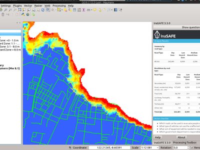
This feature was funded by DFAT/DMInnovation
This feature was developed by Kartoza
This new experimental Impact function can be used when you have people represented as census areas and wish to understand how many people may be affected. For example you may have flood polygons classified as 'wet' and 'dry' and then compute the number of people affected by 'wet' polygons. We consider this impact function as experimental and welcome your feedback with suggestions and proposed improvements.
This feature was developed by Samweli Twesa