
Project: InaSAFE
Changelog for version: 3.4.0

This is the next feature release for InaSAFE.
Issues
- Fix #2754, failed to set keyword for aggregation layer.
- Add asMultiPolygon in checker. Fix #2744.
- Fix issue #2720
- Fix #2361 count roads length in post processing instead of features
- Fix #2652: fix impact function addition over NaN values
- Fix #2152 - rubber band not removed properly after using extent selector
We also made many 'under the hood' improvements to InaSAFE including:
- Move aggregation & post processing to IF - PR #2661
- Move clipping to IF
- Wizard code cleanup ctd #2449
- Wizard to have class mappings for class based layers #2673
- Class concept mappings in metadata should be used in aggregation - if no class mappings present no breakdown in the report (we will not break down against type column if no breakdowns given) - #2675
- Impact summary as data - #2671
- IF API Stability
- Generic landcover impact function - moved from experimental to develop and polish #1216
In addition there was ongoing review of contextual help text in the InaSAFE plugin.
This feature was funded by DFAT/DMInnovation
Code Internals
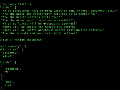
When InaSAFE produces an impact layer and accompanying report is produced. Up until InaSAFE 3.3, this report was generated as HTML for display in the dock area and in reports. In InaSAFE 3.4 we changed the implementation so that the report is written as JSON so that it can subsequently be used in different ways. For 3.4 we now write the HTML and the JSON data to disk. In future releases we will use this new feature to provide additional output formats (e.g. delimited text files for use in a spreadsheet).
This feature was funded by DFAT/DMInnovation
Impact Functions
In InSAFE 3.3 and below we expected that your data for road and building types should be in classes that matched InaSAFE's internal building type definitions. This worked well when using data downloaded from the InaSAFE OpenStreetMap downloader and less well when you used data obtained from other sources. In InaSAFE 3.4 we have addressed this issue by allowing you to create your own concept mappings when using the keywords wizard as illustrated in the animation below:
These concept mappings will then be used for the building type breakdown / road type breakdown reporting in InaSAFE. Any buildings or roads encountered that do not match one of these classes will be counted in a generic 'other' class when the report is compiled.
This feature was funded by DFAT/DMInnovation
The generic hazard on landuse classes Impact Function allows you to perform an impact assessment using a vector polygon hazard layer (e.g. generic hazard classes of high, medium, low) and a polygon exposure layer (where each polygon represents a landuse class such as urban are, croplands etc.).
Further reading: https://github.com/inasafe/inasafe/issues/1216
This feature was funded by DFAT/DMInnovation
We have added a new Impact Function for assessing the impact of tsunami raster layers on landuse polygons. The Impact Function will convert the raster layer into polygons based on the hazard thresholds (dry, low, medium, high and very high). By default the thresholds are set to:
- Dry: 0m
- Low: < 1m
- Medium: >= 1m < 3m
- High: >= 3m < 8m
- Very High: > 8m
When the impact function has completed, the impact layer will be comprised of the exposure layer clipped to the analysis extents and intersected with the hazard zone polygons.

The following actions will be reported on:
- What type of crops are planted in the affected fields?
- How long will the activity or function of the land cover be disturbed?
- What proportion of the land cover is damaged?
- What potential losses will result from the land cover damage?
- How much productivity will be lost during this event?
- Which crops were ready for harvest during this event?
- What is the ownership system of the land/crops/field?
- Are the land/crops/field accessible after the event?
- What urgent actions can be taken to normalize the land/crops/field?
- What tools or equipment are needed for early recovery of the land/crops/field?
This feature was funded by DFAT/DMInnovation